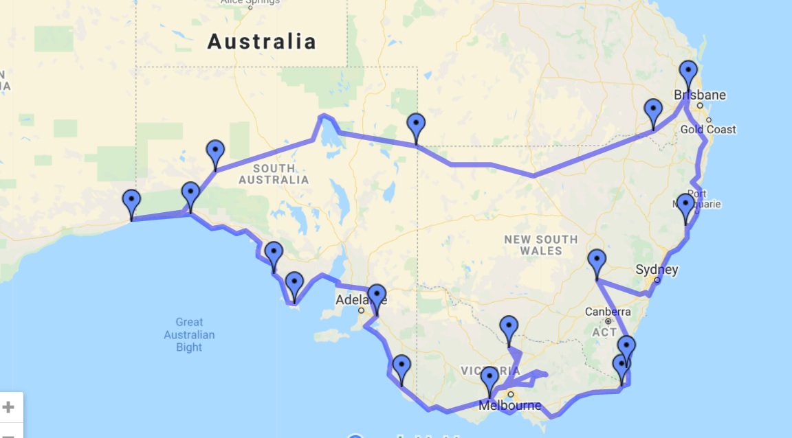
Flight to the Bight and the South Coast
A flying/camping trip to see -
'Lake' Eyre, the Nullarbor Plain, the Bight,
and the south-east coast of Australia.
3900nm, 4500mi, 7000km. May '09.

On the way to Lightening Ridge discovered these earthworks.
Are they crop circles???

These look like they could be for water retention.

This is Cameron's Corner, where three states all join.
South Australia to the left, Queensland upper right, and NSW lower right.

This is the road going westward from the corner.

'Lake' Eyre is usually a large dry salt pan,
but heavy rains farther north have flowed into it this year.

Camped on the Nullarbor Plain

Oh, oh.....

Landed out to avoid the rainstorm.

The cliffs along the Head of the Bight, the Nullarbor plain to the right.

There are many caves in this limestone plain.

The results of opening the door while in flight.
Not a good idea.....

Very convenient airstrip right next to Elliston, SA.
A seaside town but no good fish and chips shop...

Looks like very marginal farming around those sand dunes....

Mt Gambier and the crater lake.

The mouth of the Murray River.
That's all that's left after all the irrigation water taken out along the way.

The Coorong.

Mallacootta Airfield with a view.

Gabo Island airstrip.
Very tempting to land there, but it's not allowed....

A wood-chipping export facility.
Turning Australian timber into cardboard.....

Moruya, NSW.

Very strict security surrounding Moruya airfield.
Double electric fence.

Plus light beams!

Old Bar airstrip.
Very convenient to the town, caravan park and surf.

South Grafton airfield under floodwaters, May '09.
Comments
Post a Comment